Project report - riparian planting and management guidelines for tangata whenua

STATE OF THE TAKIWĀ
Te Āhuatanga o Te Ihutai
Cultural Health Assessment of the Avon-
Heathcote Estuary and its Catchment
Craig Pauling, Te Marino Lenihan, Makarini Rupene,
Nukuroa Tirikatene-Nash & Rewi Couch
Toru / July 2007


mō tātou, ā, mō kā uri ā muri ake nei
for us and our children after us
This report was produced using Takiwā 2.0 – a database developed by
Te Rūnanga o Ngāi Tahu and Environmental Science & Research, and
supported by the Ministry for the Environment
Cover Photographs:
Centre: View over Te Ihutai from the Sewage Outfal (Photograph: C. Pauling, 2007)
Bottom (Left to Right): Wairārapa Stream (Avon River) at the end of Wai-iti Terrace (Photograph: C. Pauling,
2007); Electric Fishing on the Heathcote River at Annex Road (Photograph: J.Bond, 2007); and The Ōpāwaho /
Lower Heathcote River at Garlands Road Bridge (Photograph: C. Pauling, 2007).
Whakarāpopotanga / Executive Summary
This report outlines the results of a cultural environmental health assessment of Te Ihutai/the Avon-Heathcote Estuary and its catchment undertaken by Te Rūnanga o Ngāi Tahu, in-conjunction with members of Ngāi Tūāhuriri and Ngāti Wheke, between March and May 2007. This study was carried out for Environment Canterbury as part of a wider research project being led by the Avon-Heathcote Estuary Ihutai Trust called „Healthy Estuary & Rivers of the City‟.
The purpose of the study was to undertake a review of the cultural health of the Ihutai catchment, including the Ōtākaro (Avon) and Ōpāwaho (Heathcote) rivers, through data col ected at 30 river, estuary and coastal sites using the Takiwā cultural environmental monitoring and reporting tool.
Takiwā is an environmental monitoring system developed by Ngāi Tahu that is aimed at facilitating Tāngata Whenua to gather, store, analyse and report on information in relation to the cultural health of significant sites, natural resources and the environment within their respective takiwā (tribal areas). The approach uses a series of assessment forms to enable the quantification of cultural health scores based on a number of factors including suitability for harvesting mahinga kai, physical and legal access, site pressures, degree of modification and the identification of valued as well as pest species present. Other tools including the Cultural Health Index (CHI), Stream Health Monitoring and Assessment Kit (SHMAK), E.coli testing and electric fishing surveys are also used to complement the Takiwā assessments.
Overall, the monitoring results and subsequent analysis found the catchment to be in a state of poor to very poor cultural health. Most significantly only 3 sites, Pūtarikamotu (Deans Bush), Te Karoro Karoro (South Brighton Spit) and Tuawera (Cave Rock/Sumner Beach) were considered good enough to return to.
Site and water quality in the Avon catchment was found to be healthier than in the Heathcote catchment. However, native species abundance was found to be greater in the Heathcote catchment, and poorest at estuary and coastal sites. In particular, the impacts of historical and ongoing drainage and untreated stormwater, the loss of native vegetation, including wetlands, grasslands and lowland forests, and the decline of water quantity within the catchment were identified as major issues influencing the assessment. Of most concern, however, were the e.coli and anti-biotic resistance results which show widespread contamination from both human and agricultural sources in the catchment.
Although the catchment received a poor assessment, a number of sites and features were seen as positive, and provide ideas for how future management may be able to improve the cultural health of the Ihutai catchment. These include the presence and abundance of remnant and/or restored native vegetation at sites such as Pūtarikamotu (Deans Bush), Waikākāriki (Horseshoe Lake), Ōruapaeroa (Travis Wetland), the Wigram Basin and Westmorland, as well as the occurrence of freshwater springs at Jellie Park and Templetons Rd.
Protecting, enhancing and extending such areas and features and investigating and eliminating sources of contaminants wil be the most important challenges for the future management of the Ihutai catchment. Ongoing monitoring, including cultural assessments wil be vital in understanding the success, or otherwise, of any such actions.
Te Āhuatanga o Te Ihutai: Cultural Health Assessment of the Avon-Heathcote Estuary i
Rārangi Ūpoko / Contents
Te Āhuatanga o Te Ihutai: Cultural Health Assessment of the Avon-Heathcote Estuary ii
1 Te Whakatuwheratanga / Introduction
Te Ihutai/the Avon-Heathcote Estuary and its tributaries, the Ōtākaro/Avon and Ōpāwaho/Heathcote Rivers are iconic cultural, recreational and ecological features of Christchurch City and the wider Canterbury area. Yet, as a consequence of the development of both the city and the community it supports, the estuary and its catchment have undergone dramatic change and degradation, particularly in relation to indigenous flora and fauna, and water quality.
For Tangata Whenua, these impacts have had a direct and significant impact on the customary relationship with the Ihutai catchment, and resulted in the estuary and its catchment being of little, if any, value as a mahinga kai (customary food/source).
While some of the issues facing the Ihutai catchment have been documented, very little is known about the extent of change that has taken place for, or how the current health of the catchment is viewed by, Tangata Whenua. This report therefore outlines the results of a cultural environmental health assessment study that marks the first attempt to quantify these issues from a Tangata Whenua perspective.
The assessment was undertaken by Te Rūnanga o Ngāi Tahu, in-conjunction with members of Ngāi Tūāhuriri and Ngāti Wheke, between March and May 2007, as part of a wider water monitoring programme being facilitated by the Avon-Heathcote Estuary Ihutai Trust and supported by the Christchurch City Council, Environment Canterbury and the Ministry for the Environment.
The study col ected data from 30 sites within the Ihutai catchment using the Takiwā cultural environmental monitoring and reporting tool. This included the use of the Takiwā site assessment, Cultural Health Index and Stream Health Assessment and Monitoring tools, E.coli and anti-biotic resistance testing as wel as electric fishing surveys. The field-collected site data was subsequently loaded into the Takiwā database to enable a catchment analysis to be undertaken.
Specifical y, the report is structured in the fol owing way:
Section 1 introduces the report with a brief background to the study,
including major drivers, aims and objectives.
Section 2 gives an overview of the State of the Takiwā Database and
Monitoring tool used within the study and to produce this report.
Section 3 gives an overview of the process and methods of data col ection,
including those of Takiwā and the other tools used during the study.
Section 4 gives the results of the study, including the literature review of
traditional health and associations, site assessment data and a discussion of the current cultural health of the Ihutai catchment.
Final y, Section 5 concludes the report with a summary of major points and
recommendations of the study.
Te Āhuatanga o Te Ihutai: Cultural Health Assessment of the Avon-Heathcote Estuary 1
1.1 Tāhuhu Kōrero / Background Te Ihutai and its catchment are of immense cultural and historical importance to Tangata Whenua, being a place of significant settlement and food gathering by Waitaha, Ngāti Mamoe and Ngāi Tahu for over 600 years. Sites along both the Avon and Heathcote Rivers, in and around the estuary, and on the coastline near the mouth of the estuary were known and used due to the availability and abundance of mahinga kai resources. Freshwater fish and shel fish, as well as numerous native plant resources, waterfowl and forest birds could be gathered from the network of springs, waterways, swamps, grasslands and lowland podocarp forests that made up the estuary catchment, much of which was stil present at the time of European settlement (Tau, Goodall, Palmer & Tau 1990; Christchurch City Libraries 2006; Christchurch City Council 2007).
The modern settlement and development of the city of Christchurch has, however, had a dramatic impact on the health of the entire catchment, and inturn the values Tangata Whenua have for the area. Drainage of the original swamplands has lead to extreme sedimentation within both the Avon and Heathcote Rivers and the estuary itself. Industrial and residential development has seen the destruction of extensive areas of native vegetation, the degradation of water quality and the local extinction and/or degradation of native fish and bird species, as well as the depositing of pol ution and toxins within the catchment. The taking of the Te Ihutai Māori Reserve in 1956 under the Public Works Act as part of the Christchurch sewage works development and the subsequent discharge of human effluent into the estuary have compounded these, and created further problems (Bolton-Ritchie, Hayward & Bond 2006; Tau et al 1990).
Recently however, and in response to this, the Avon-Heathcote Estuary Ihutai Trust embarked on an ambitious and important journey to improve the health of the estuary and its catchment, releasing the Ihutai Management Plan in 2004 (Avon-Heathcote Ihutai Trust 2004). Following this, the Trust developed a comprehensive water quality monitoring programme entitled „Healthy Estuary and Rivers of the City‟ (Bolton-Ritchie et al 2006) aimed at identifying long term environmental changes, assessing current water quality, and developing a baseline of information that may assist in measuring the success of, and inform, the restoration and future management of Te Ihutai.
To carry out this programme, the Trust identified the need to involve Tangata Whenua and gather water quality data that would be able to take into account historical and cultural values associated with Te Ihutai, including mahinga kai. Te Rūnanga o Ngāi Tahu were engaged by the Trust to facilitate this element of the programme through the use of its Takiwā cultural environmental monitoring and reporting tool.
1.2 How did this study come about? After hearing about the pilot State of the Takiwā study completed by Te Rūnanga o Ngāi Tahu for the Waiau River in Southland (Pauling, Mattingley & Aitken 2005), and a subsequent study within the Wairewa/Lake Forsyth Catchment (Pauling, Cranwell & Ataria 2006), Jenny Bond of Environment Canterbury contacted Craig Pauling at Te Rūnanga in early 2006 to discuss the possibility of undertaking cultural monitoring as part of the monitoring programme planned for the estuary by the Avon-Heathcote Ihutai Trust.
Te Āhuatanga o Te Ihutai: Cultural Health Assessment of the Avon-Heathcote Estuary 2
After several further conversations and a successful funding application by the Trust, Jenny contacted Craig again in mid 2006 to confirm if Te Rūnanga could be part of the project to provide training and coordination of cultural monitoring for Te Ihutai. In the meantime, Te Rūnanga o Ngāi Tahu had been successful with their own funding application to further develop the Takiwā cultural environmental monitoring and reporting tool.
Te Rūnanga then organised and ran a workshop at Wairewa Marae, Little River in late October 2006 with local Papatipu Rūnanga in relation to Takiwā and future fieldwork involving the tool. Environment Canterbury participated in the workshop and Jenny Bond outlined the Ihutai project, along with other monitoring related initiatives to rūnanga participants. Te Marino Lenihan of Ngāi Tūāhuriri expressed an interest in the Ihutai project and a further meeting was planned to discuss Ngāi Tahu involvement.
In March 2007, Craig Pauling met with Te Marino Lenihan, Makairini Rupene and Jenny Bond to further develop the project and began to develop aims and objectives for the study as well as identifying potential monitoring sites within the Ihutai catchment. Craig Pauling also informed Rewi Couch of Ngāti Wheke about the study and invited him to be involved in the fieldwork.
From the meeting and conversations a plan and budget was developed for the study, with monitoring work commencing in mid-March 2007. A full copy of this plan is included as Appendix A to this report. The aims and objectives of the study, summarised from the plan, are outlined below.
1.3 Ngā Whāinga / Study Aims and Objectives The major objective of the study was to:
Undertake a review of the cultural health of the Ihutai catchment, including
the Ōtākaro (Avon) and Ōpāwaho (Heathcote) rivers, through the gathering, analysis and reporting of data col ected using the Takiwā cultural
environmental monitoring and reporting tool.
This objective was supported by the following aims, to:
Identify monitoring sites and targets in the Ihutai catchment, important
resources such as people and equipment needed and develop a plan for the gathering of data in conjunction with rūnanga monitoring team members (March 2007).
Provide training to rūnanga monitoring team members in the use of the
Takiwā tool and other environmental monitoring processes (March 2007).
Undertake the gathering of data for the Ihutai catchment, using Takiwā,
CHI, SHMAK and E.coli assessments at selected sites from the source to the sea (Ki Uta Ki Tai) and input the col ected data into Takiwā 2.0 (by May 2007).
Analyse the col ected data and complete a cultural health baseline report
for the Ihutai catchment to assist future management and planning and to contribute to the „Healthy Estuary and Rivers of the City‟ monitoring programme (by June 2007).
Te Āhuatanga o Te Ihutai: Cultural Health Assessment of the Avon-Heathcote Estuary 3
2 Te Puna / Takiwā Monitoring Tool
The Takiwā Monitoring tool used within this study is an important factor in the development of this report. To fully appreciate and understand the data presented in this report, it is therefore important to outline how the Takiwā database and monitoring forms are structured and used. The following sub-sections therefore give an overview of the key features of the database and monitoring forms and how these helped to create this report.
2.1 What is State of the Takiwā? State of the Takiwā is an environmental monitoring approach developed by Te Rūnanga o Ngāi Tahu as part of their Ki Uta Ki Tai - Mountains to the Sea Natural Resource Management framework (Pauling 2004) and outlined in the tribal vision, Ngāi Tahu 2025 (Te Rūnanga o Ngāi Tahu 2003). Its development has been partly funded by the Ministry for the Environment and supported by Environmental Science and Research, Manaaki Whenua Landcare Research, NIWA, Envirolink Southern Community Laboratories, Environment Southland and Environment Canterbury.
In simple terms, State of the Takiwā describes a cultural values based environmental monitoring and reporting system that is aimed at facilitating Tāngata Whenua to gather information, assess and report on the cultural health of significant sites, natural resources and the environment within their respective takiwā, that wil in turn assist them in managing the environment into the future.
State of the Takiwā is a play on words from the conventional, largely western science based State of the Environment approach, but that takes into account Māori cultural values, such as mauri and mahinga kai, and that aims to complement standard scientific measures of environmental health.
Ngāi Tahu 2025 defines State of the Takiwā as "[a]n environmental monitoring and reporting approach that integrates Mātauranga Māori and Western Science to gather information about the environment and to establish a baseline for the creation of policy and improvement of environmental health. A programme developed as an alternative to conventional state of the environment reporting used by the Ministry for the Environment that takes into account Tāngata Whenua values" (TRoNT 2003, p47-48).
The major objective behind State of the Takiwā is to ensure that Tāngata Whenua can build robust and defensible information on the health of the environment, which can in turn be used to assess the effectiveness of both internal policy and practices as wel as those of external agencies, including local councils who have statutory responsibilities to undertake monitoring and report on the state of the environment (Pauling 2003).
Central to the approach is the gathering of information on the health of the environment using specially developed data-forms and the collation of this information into a specifical y designed database from which analysis is possible and reports can be prepared. An overview of the Takiwā forms and database is included below.
Te Āhuatanga o Te Ihutai: Cultural Health Assessment of the Avon-Heathcote Estuary 4
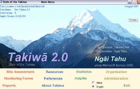
2.2 The Takiwā Database Takiwā is a special y developed Microsoft Access 2002 runtime application linked to a physical y separated database, which can be run on any PC by downloading it from an instal ation CD-ROM. The database is password protected, and al data entries are automatical y stamped with the initials of who created it and when, and who last modified it. The database also has facilities for creating dated backup copies of the data tables, which can be stored remotely to ensure the safety of the data. It also includes an easy to use Helpfile and has a bi-lingual interface that can display key headings in either Te Reo Māori or English, depending on the current user‟s preference.
The primary aim of the Takiwā database is to facilitate data col ection and make information available to Tāngata Whenua, to help them identify and quantify the current or changing quality of a particular site, and to be able to report this data in an easy, clear and repeatable way. This is achieved by the inclusion of a site assessment module for storing, analysing and reporting data collected on particular sites, and a print centre where monitoring forms for data collection and standard reports can be produced.
Site Assessment Module
The Site Assessment module identifies environmental monitoring sites and records details from both present-day visits by participants as well as historical information. Data gathered is in a combination of reasoned multi-choice evaluation of criteria (eg. access for harvesting: 1 = very poor -- 5 = very good), and ad-hoc comments of visitor impressions (see Figure 1 below). Within this module, details based on Takiwā Monitoring, Cultural Health Index and SHMAK forms can be entered to describe a geographically-defined site and the details of the visit as wel as being able to assess environmental and other qualities in a consistent fashion over time.
Figure 1. Takiwā Site Assessment Module
Te Āhuatanga o Te Ihutai: Cultural Health Assessment of the Avon-Heathcote Estuary 5
The structure of the database ensures that, in the future, the data can be interrogated to answer such questions as:
Has quality improved or deteriorated over the years?
How many sites of interest exist in different areas?
How much information is available on that area?
Who has visited it (for assessment) and when?
Have native birds, plants, etc improved or deteriorated over the years?
At which sites have people seen kererū, totara, or other listed taonga?
How have their presence changed over the years?
The Site Assessment module also includes a section label ed „journal‟ where important historical information and references about a particular site can be stored. A further feature is the image portal where an unlimited number of photographs or other diagrams (.jpg, .gif or .bmp format) can be associated with the site.
In order to grade and compare sites and visits, index calculations have been included within the database. These include an overal site health assessment index, a species abundance index, and the Cultural Health Index for waterways (Tipa & Tierney 2003 & 2006). The Site Assessment module also includes a module to enter data from the Stream Health Monitoring and Assessment Kit (Biggs, Kilroy & Mulcock 2000) and to produce scores for stream habitat quality, and invertebrate and periphyton health. Al indexes can be recalculated for either the current questionnaire, or for al questionnaires in the database (Mattingley 2005).
Takiwā Monitoring Forms
Takiwā includes a series of special y developed monitoring forms which can be printed directly from the database, used to gather information about sites and facilitate the storage and reporting of data from the field. These include the Takiwā Site Definition, Visit and Assessment forms. Takiwā also currently includes forms for the Cultural Health Index and Stream Health Monitoring and Assessment Kit.
The aim of the Takiwā monitoring forms are to record observations and assessments by tāngata whenua for a particular site and at a particular time relating to key cultural values and indicators of environmental health, such as mahinga kai. The forms were developed through discussion with both tāngata whenua groups and monitoring experts and by reviewing previously developed monitoring tools.
Feedback dictated that the monitoring forms needed to be simple, rather than being overly complicated or abstract and that the forms should attempt to capture the cultural information and values about a site, which is normally internalised during mahinga kai (food gathering) or similar activities and often cal ed „anecdotal information‟.
The overal goal of the data col ection and storage achieved by the form and database was to make this important information more defendable, accessible, useable and quantitative.
Te Āhuatanga o Te Ihutai: Cultural Health Assessment of the Avon-Heathcote Estuary 6
Forms and indicators from other monitoring toolkits were investigated and used to identify relevant formatting as well as the type of questions that could be used to capture appropriate information in relation to cultural values and indicators. These included:
Kaimoana Monitoring Guidelines (Otaraua Hapū 2003);
Cultural Steam Health Index (Tipa & Tierney 2003);
Iwi-Stream Health Monitoring and Assessment Kit (Ogilvie & Penter 2001);
Māori Indicators Wetland Monitoring Tool (Harmsworth 2002);
Forest Monitoring and Assessment Kit Site Assessment Kit (Handford &
Associates Ltd 2003);
NIWA Freshwater Fish Database Form (NIWA 2003).
From this analysis and discussion with Tāngata Whenua and other experts, the following indicators were identified as being most important to include in the main Takiwā monitoring form:
Heritage/Site Significance;
Amount of pressure on the site from external factors;
Levels of modification/change at a site;
Suitably of the site for harvesting mahinga kai;
Access issues in relation to the site;
Overal health/state of a site;
Presence, abundance and diversity counts for native bird, plant and fish
species, other cultural y significant resources as wel as exotic (including pest and weed) species; and
Wil ingness to return to the site.
Other details that were seen as being important to record were in relation to general visit and site details (date, time, weather conditions, site location, legal protection etc). This was achieved by the development of two separate but interdependent forms – The Site Definition and Visit Details Form. The visit details form also includes prompts to ensure photographic references are recorded for a site.
Examples of al the forms included in Takiwā and used in this study are shown in Appendix B.
Takiwā Reporting Functions
The final critical feature of the Takiwā database is the printable query and reporting function. This function allows users to print a range of reports by simply selecting the type of report (from a range of options) and pushing a print button within the database. These reports can also be exported to Word or Excel to assist in report writing or graphic representations of the data.
This is made possible through a „Print Centre‟ that offers a range of different reports for sites, visits and questionnaires. The print centre is accessed through buttons on both the Takiwā Main screen and on the Site Evaluation screen. When a user in is the print centre, it already knows which Site, Visit and Questionnaire were last used on the Site Evaluation screen, and these are listed, with the last one viewed being already selected.
Te Āhuatanga o Te Ihutai: Cultural Health Assessment of the Avon-Heathcote Estuary 7
3 Ngā Kauneke / Methods
The data col ection undertaken within this study was conducted over 6 days between the 16th of March and the 11th of May 2007, at 30 sites situated along the Avon and Heathcote rivers, around the Avon-Heathcote Estuary and along the Canterbury Coast at New Brighton and Sumner.
The monitoring team consisted of members from Ngāi Tūāhuriri, Ngāti Wheke and Te Rūnanga o Ngāi Tahu and were supported by Environment Canterbury, the Avon-Heathcote Ihutai Trust and Envirolink Southern Community Laboratories.
The data col ection primarily involved cultural health site assessments using the Takiwā tool. This was further complemented by the use of the Cultural Health Index, Stream Health Monitoring and Assessment Kit and electric fishing surveys at all river sites, and the collection and testing of water samples from all sites for the analysis of E.coli and antibiotic resistant E.coli.
The following sub-sections give an outline of the people involved, equipment used, sites assessed, and methods used to collect data at each site, as well as an overview of the background research and data analysis undertaken.
3.1 Tāngata Arotake / Monitoring Team The following people were involved in the study and fieldwork:
Te Marino Lenihan (Ngāi Tūāhuriri)
Makarini Rupene (Ngāi Tūāhuriri)
Nukuroa Tirikatene-Nash (Ngāi Tūāhuriri)
Rewi Couch (Te Hapū o Ngāti Wheke)
Craig Pauling (Te Rūnanga o Ngāi Tahu)
3.2 Taputapu Arotake / Monitoring Equipment The following equipment was used during the study and fieldwork:
Vehicles (Private) Takiwā forms, CHI forms, SHMAK Kit, manual and forms Electric Fishing Machine, Probe and Nets Waders and Protective Jacket/Gear E.coli kit (Vials, Chil y pads, Chil y Bin, Forms) Digital Camera, GPS unit and Binoculars Maps and Monitoring Plan Pens, folders and identification booklets First Aid Kit Tea and Coffee Laptop and Takiwā software (for the storage and analysis of data)
Te Āhuatanga o Te Ihutai: Cultural Health Assessment of the Avon-Heathcote Estuary 8
3.3 Wāhi Arotake / Monitoring Sites Monitoring sites were chosen from the entire Ihutai catchment to gain a good mix of traditionally significant sites, land use issues, historical changes, as well as sites of contemporary significance. Some sites were also chosen to correspond with sites being used for other water quality monitoring in the wider programme, while other sites were simply chosen due to access issues.
Al sites were purposely selected to represent a „Ki Uta Ki Tai‟ or source to sea philosophy, being situated along the Avon and Heathcote rivers, around the Avon-Heathcote Estuary and along the Coast at New Brighton and Sumner. This included identifying sites within the source tributaries, drains and springs of both the Avon and Heathcote rivers, including Dudley Creek, Wairārapa Stream, Ilam Stream, Waimairi Stream, Horseshoe Lake, Travis Wetland (Avon catchment) and Wigram Basin and Cashmere Stream (Heathcote catchment). The sites assessed during the study are listed below along with an indication of the site significance and major surrounding land use issues.
Site Name
Ōtākaro / Avon River
Avonhead @ Russley Rd Western most source of the Avon River and
Waimairi Tributary
Burnside Park / West
Source of West Burn Tributary flowing into
Waimairi and significant recreational area – rugby, soccer and cricket
Source of Dudley Creek, northern most tributary
Wairārapa Stream @
Near source of Hewlings Stream and Wairarapa
Stream, including spring fed lake and significant recreational area within urban park – public pool, skatepark
Waimairi Stream @
Mid-catchment reference (ease of access)
Ilam Stream @ Athol
Source of Ilam Stream tributary
Pūtarikamotu / Ilam
Traditional settlement and food gathering site,
Stream @ Deans Bush
remaining native forest remnant, protected
Waipapa / Little Hagley
Traditional settlement and food gathering site,
upper most main channel site
Ōtautahi / Kilmore St
Traditional settlement and food gathering site
Contemporary recreational site – rowing /waka
ama /hockey and complimentary sample site.
Te Oranga / Horseshoe
Traditional settlement and food gathering site,
significant urban drainage sink and
native/natural wetland/spring remnant
Ōruapaeroa / Travis
Traditional settlement and food gathering site,
significant urban/rural drainage sink and
native/natural wetland remnant
Contemporary recreational area – waka ama,
former public works site and lower most Avon
Te Āhuatanga o Te Ihutai: Cultural Health Assessment of the Avon-Heathcote Estuary 9
Ōpāwaho / Heathcote River
Wilmers Rd/Warren Park
Source of main Heathcote River, upper most
catchment site, between Warren Park
(recreational area) and Wigram Air base
Significant source spring of upper Heathcote
River between rural land, urban development
and significant recreational reserve, and
complimentary sample site.
Significant drainage sink and historic sources of
upper Heathcote river – contemporary
recreational area – rugby league, horse riding,
agricultural show grounds, area also owned by
Ngāi Tahu Property
Te Heru o Kahukura /
Situated between Ngāi Tahu Property subdivision Urban /
development, Linden Grove (former Sunnyside
Hospital) and Spreydon Primary School, and
complimentary sample site.
Waimokihi / Pioneer
Significant recreational area – public pool,
soccer and cricket as well as site of Kura
Kaupapa Māori, and complimentary sample site. School
Near source of Cashmere Stream tributary
Beckenham Library
Mid-catchment reference
Ōpāwaho / Garlands
Traditional settlement and food gathering site
Woolston Industrial
Settlers Reserve /
Inter-tidal, lower most Heathcote river site,
adjacent to new Māori tourism development
Te Ihutai / Estuary
Te Kai a Te Karoro /
Traditional settlement & food gathering site and
contemporary recreational site, and
complimentary sample site.
Te Karoro Karoro / South Traditional settlement and food gathering site on Reserve/ Brighton Spit
northern mouth of Estuary
Outfall of Bromley Oxidation Ponds and near
Pleasant Point Yacht Club and opposite Te Kai o
Te Raekura / Redcliffs
Traditional settlement and food gathering site,
beach access and complimentary sample site.
Rapanui / Shag Rock
Traditionally significant site, contemporary
recreational swimming area, and complimentary Beach sample site.
Te Tai o Maha-a-nui / Pegasus Bay
Tuawera /Cave Rock
Traditionally significant site, contemporary
recreational swimming/surfing area, and
complimentary sample site.
Ōruapaeroa / New
Traditionally significant site, contemporary
recreational swimming/surfing area
Commerce / Coastal
The location of these sites are shown on map 1 on the following page.
Te Āhuatanga o Te Ihutai: Cultural Health Assessment of the Avon-Heathcote Estuary 10
Te Āhuatanga o Te Ihutai: Cultural Health Assessment of the Avon-Heathcote Estuary 11
3.4 Kauneke Arotake / Data Collection & Assessment
The data col ection undertaken within the study involved the fol owing types of assessment:
1. Takiwā Site Assessments (all sites); 2. E.Coli Water Testing (all sites, except Avonhead & Westburn); 3. Cultural Health Index (CHI) Waterway Assessments (river & stream sites only); 4. Stream Health Monitoring (SHMAK) Assessments (river & stream sites only,
except Avonhead, Westburn and Wigram Basin);
5. Electric Fishing Surveys (freshwater sites only, except Avonhead, Westburn,
Dudley, Royds, Athol, Pūtarikamotu, Waipapa, Ōtautahi & Wigram).
Further details of the methods for the different assessment methods used in the study are outlined in the following sub-sections. The general process followed for the data col ection at all sites involved the following steps:
After arriving at the site, the monitoring team gathered together so that any
appropriate mihi, karakia and/or kōrero could be given.
The team then completed the Site Definition and Visit Details forms,
including obtaining GPS coordinates and photographic records for the site.
The team then completed the Takiwā site assessment form and gathered
the water sample for E.coli testing. At al river/stream sites the team then undertook the various tests as part of the SHMAK kit, completed the Cultural Health Index water quality form, before final y undertaking an electric fishing survey of the site.
Before departing, a general kōrero/discussion was held about the site, and
travel and other details about the next site and/or activity.
Takiwā Site Assessments
The first step of the Takiwā site assessment involved completing the Site Definition form. This required recording information on the site name, referring to both traditional and current names, the location, legal protection issues, and the traditional significance and condition of the site, as well as recording the exact geographical details using a GPS receiver. For Takiwā assessments, a site is defined as the area within 100 metres of the point of monitoring.
In the second step, visit specific details such as the individuals involved, the date, time, weather conditions and other information relevant to the visit, including photographic records are then recorded on the Visit Details form.
The third step involved completing the site assessment form. The first part of the site assessment form involved ranking the fol owing aspects of site health using a 1 to 5 scale, where 1 is the least/worst score and 5 is the highest/best score:
Amount of pressure from external factors; Levels of modification/change at the site; Suitably for harvesting mahinga kai; Access issues; Wil ingness to return to the site (simply a yes or no answer); and Overal state/health of the site.
Te Āhuatanga o Te Ihutai: Cultural Health Assessment of the Avon-Heathcote Estuary 12
The second part of the site assessment form involved undertaking abundance and diversity counts for native bird, plant and fish species, other resources (such as stone, bone or driftwood) as well as introduced plant and animal species. This was achieved via visual and aural identification of individual species along with a weighting given to their relative abundance (few/some/many) at the site. The assessment of fish species was undertaken at all river sites through electric fishing (see section 3.4.5 below).
The assessment of taonga plant species also included a question to indicate the relative dominance of native species versus exotic or weed species at the site. This is represented as a percentage of the total site area covered by the taonga plants and gives an important indicator of change at the site over time.
From this information, index scores are quantified for overall site health (total averaged factor scores out of 5) and species abundance (an open ended number, which can be positive or negative and where higher is better). The site health score is then assigned a rank from very good to very poor and used in the overal analysis of the catchment (Pauling 2007).
E.Coli Water Testing
E.coli water testing involved two assessments, using a single 100ml water sample collected from each site:
Laboratory analysis to quantify the total E.coli in the sample (per 100mls).
Further laboratory analysis of the sample to identify the main source of any
E.coli present in the river water, through antibiotic resistance analysis.
Water samples were collected in plastic screw top 100ml vials, labelled with the site code, put on ice in a chil y bin, and delivered to Hill‟s Laboratory for analysis within 24 hours. Results from the laboratory analysis were then sent back to the monitoring team for inclusion in the analysis of the study.
E.coli testing was not completed at the Avonhead and Westburn sites due to there being no water present in the streams at the time of monitoring.
Background to E.coli and Anti-biotic Testing
Faecal Coliforms are a group of bacteria that include E.coli. Members of the coliform group also include other bacteria that may be found in the soils, and also in the intestines of birds. A positive faecal coliform result therefore indicates the possibility of faecal contamination, but is not totally reliable.
The presence of E.coli, however, indicates contamination with faecal material from the intestinal tract of a mammal or birds. As a general rule, the drinking water standard uses the detection of 1 E.coli in 100ml of water as rendering it unfit for human consumption (Ministry of Health 2000). There are also standards for shel -fish gathering and contact recreation (Ministry for the Environment 2003). A summary of these standards are included as Appendix C of this report.
Drinking water supplies susceptible to contamination with sewage or other excreted matter may cause outbreaks of diarrhoea or intestinal infections. Kaimoana gathered near faecal y contaminated water may also contain intestinal pathogens because shel fish filter and concentrate organisms inside their body.
Te Āhuatanga o Te Ihutai: Cultural Health Assessment of the Avon-Heathcote Estuary 13
It is sometimes difficult to detect bugs like campylobacter that cause health problems, because they occur in very low numbers. Instead we rely on tests that wil reveal the presence of bugs associated with faeces (such as E.coli and faecal coliforms) that show contamination of the water, but do not usual y cause harm themselves.
A further piece of analysis that can be carried out with E.coli is the detection of antibiotic resistance. Antibiotic resistance in E.coli is a strong indication that the E.coli has previously been exposed to antibiotics, or has acquired the antibiotic resistance factor by association with an E.coli containing the factor. Specific antibiotics (eg. Apramycin) are uniquely associated with the agricultural use of antibiotics, and the detection of this resistance indicates agricultural origin of the E.coli. Resistance to other antibiotics used solely by humans can therefore indicate contamination from human effluent and so on. Moreover, a sample showing no resistance or „sensitivity‟ indicates the contamination is from a natural source, such as a bird or from the soil (Pauling et al 2005).
Cultural Health Index Waterway Assessment
The Cultural Health Index (CHI) was developed by Gail Tipa and Laurel Tierney with support from the Ministry for the Environment and Te Rūnanga o Ngāi Tahu. The original CHI was completed in 2003 (Tipa & Tierney 2003), with a revised version being published in 2006 (Tipa & Tierney 2006).
The methodology for the Cultural Health Index is very similar to the Takiwā site assessment, where a form is completed relating to a number of ranking questions, along with the identification of valued bird, plant and fish species. The major difference is that the Cultural Health Index is focussed solely on assessing the cultural health of the waterway at a particular site, rather than land resources over the entire site. Other obvious differences are the exclusion of assessments for pest and weeds and other resources. Another difference in the CHI is the grading and scoring system associated with it.
The CHI has three components - traditional association, mahinga kai and stream health. To derive the index at a particular stream site, first traditional association is identified, then mahinga kai values are assessed, and final y cultural stream health is evaluated. Almost all the necessary data for these measures are derived from the recording forms.
Component 1 – Site status
This identifies whether or not the site is of traditional significance to Tāngata Whenua and can be determined when the sites are first selected. The second part of the status grade indicates whether Tāngata Whenua would return to the site in future.
Stream sites are classified according to traditional association and intention to use in the future, including:
Is there a traditional association between Tāngata Whenua & the site? Sites
of traditional significance are assigned an 'A'. Sites that do not have a traditional association are assigned a 'B'.
Would Māori come to the site in the future? Whether the Tāngata Whenua
would return to the site or not is also recorded. If the Tāngata Whenua would return, the site is awarded a 1, and if not, a 0.
Te Āhuatanga o Te Ihutai: Cultural Health Assessment of the Avon-Heathcote Estuary 14
Component 2 – Mahinga kai
Examining the health of mahinga kai recognises that mauri is tangibly represented by the physical characteristics of a freshwater resource, including the indigenous flora and fauna, the fitness for cultural usage and its productive capacity.
The mahinga kai measure has four elements, each of which is scored on a 1–5 basis (1 is poor health, 5 is very healthy):
1. Identification of mahinga kai species present at the site. A score is given
depending on the number of species present. The productive capacity of a site is reflected in the ability of the freshwater resource to yield mahinga kai.
2. Comparison between the species present today and those sourced
traditional y from the site. A score is given based on the number of species of traditional significance that are stil present. Maintaining cultural practices, such as the gathering of mahinga kai, is an important way of ensuring the transfer of cultural values through the generations.
3. Access to the site. Do Tāngata Whenua have physical and legal access to
the resources they want to gather?
4. Assessment of whether Tāngata Whenua would return to the site in the future
as they did in the past.
The four mahinga kai elements are then averaged to produce a single score between 1 and 5.
Component 3 – Cultural stream health
The cultural stream health measure is the average of 1–5 scores awarded to each of eight individual indicators:
1. Water quality
5. Riparian vegetation
2. Water clarity
6. Riverbed condition/sediment
3. Flow and habitat variety
7. Use of riparian margin
4. Catchment land use
8. Channel modification
The Overall Cultural Health Index
The three components are brought together in an overal Cultural Health Index score. When the CHI is calculated for a specific site, a score is generated and
expressed as: A-0 / 2.1 / 4.2 where:
A identifies the site as traditional (rather than a B for non-traditional)
0 indicates that Māori would not return to this site in the future (1 indicates
they would return)
2.1 is the mahinga kai score (score of 1-5)
4.2 is the overall evaluation of stream health (score of 1-5)
(Tipa & Tierney 2003 & 2006)
Stream Health Monitoring (SHMAK) Assessment
The Stream Health Monitoring and Assessment Kit (SHMAK) was developed by the National Institute of Water and Atmospheric Research (NIWA) in partnership with Federated Farmers of New Zealand and partly funded by the Ministry for the Environment (MfE) (Biggs et al 2000).
Te Āhuatanga o Te Ihutai: Cultural Health Assessment of the Avon-Heathcote Estuary 15
An Iwi-SHMAK kit was also developed by NIWA in partnership with Te Rūnanga o Ngāi Tahu and funded by MfE (Ogilvie & Penter 2001).
SHMAK allows the measurement of water flow/velocity, pH, temperature, conductivity, clarity, streambed composition, riparian vegetation, invertebrates, periphyton and catchment activity through the use of a number of monitoring instruments and the recording of data onto forms. The information collected is ranked using a scoring system to understand how healthy the stream is and how it may be changing over time.
SHMAK was used to collect the fol owing types of data and using the following methods:
Biological Data
Common and easily recognised biological indicator organisms known to be characteristic of certain stream health conditions were observed and/or counted, including:
Types of stream invertebrates (e.g., insects, snails).
Types of periphyton (algae/slimes on the bed of the stream).
This was achieved by scooping samples into containers and using an identification sheet to identify and record the different species present.
Stream Habitat Data
Measurements and observations of physical and chemical conditions at a monitoring site, consisting of:
Water velocity (measuring the time it takes an object to float a set distance
Water pH (using pH strips dipped in a separate water sample from the site); Water temperature (using a thermometer dipped in a separate water
Water conductivity (using a conductivity meter dipped in a separate water
Water clarity (using a water clarity tube fil ed with water from the site) Composition of the stream bed (by observation and estimation of
percentages of rocks, gravels, sand, plants, etc);
Presence and extent of loose, silty deposits on the stream bed (by
observation and estimation according to a set guide); and
Stream-bank vegetation at the site (by observation and estimation of
percentages of different types of vegetation).
Each monitoring observation was recorded on special forms and assigned a score. Individual factor scores were then combined to develop overal scores for stream habitat, invertebrates and periphyton health. An overal rating for sites was then calculated based on pre-determined rankings within the SHMAK methodology. These scores depend on the type of stream which is inturn based on the composition of the stream-bed and the relative abundance of fine substrates in the bed (Biggs et al 2000). SHMAK data was collected from all river and stream sites, except Avonhead and Westburn (no water), and Wigram Basin (incomplete data due to equipment failure).
Te Āhuatanga o Te Ihutai: Cultural Health Assessment of the Avon-Heathcote Estuary 16
Electric Fishing
Electric Fishing is a method widely used to survey fish within wadeable rivers and streams. The method involves the use of a special y designed machine that creates an electric field in the water that temporarily stuns fish to facilitate their capture in nets for closer inspection and identification.
This study utilised the Kainga EFM 300 packset in-conjunction with a hand held scoop net and larger mesh net. The EFM 300 consists of a battery-powered
backpack generator unit, a fibreglass wand with cathode, and an earthing wire. The machine allows output voltage, frequency, and pulse width to be control ed and also incorporates a timer that records the number of minutes in use. The EFM 300 also includes four separate safety circuits to maximise user safety. Both machine and net operators wear ful length neoprene waders and rubber safety gloves, with cotton inners during surveying (NIWA 2007).
Surveys were typical y conducted over a 10-20 metre stretch of river at each monitoring site and involved one pass on each bank, taking between 10-20 minutes in total. Voltage settings were normally 300 volts and adjusted to optimise the electric field according to the indicator on the wand. Fish were scooped out, counted and inspected to ascertain the species type and record their general size, before being returned to the water. At some sites a selection of fish were also photographed. Data on fishing time, distance of river fished,
fish numbers, species and size were recorded on the fish section of the Takiwā site assessment form. Electric fishing data was not able to be gathered at a number of sites due to equipment failure or unavailability.
3.5 Background Research and Data Analysis A literature review was also undertaken as part of the study to gather information relevant to the Ngāi Tahu association with the Ihutai catchment. This was also done to gain an understanding of past environmental health and species occurrence as well as an appreciation of the environmental changes the estuary catchment has undergone. This research also provided information on the occurrence of traditional species at specific sites that is vital for the analysis and reporting of data for both the Takiwā and Cultural Health Index assessments.
After the fieldwork was concluded, data from the completed monitoring forms was loaded into the Takiwā database, from which scores for the Takiwā, Cultural Health Index and SHMAK assessments were calculated. These scores were then analysed and graphed using excel to show the relative rankings of the sites from very good to very poor. Other data was also extracted from the database in relation to the presence and abundance of native and exotic species and how these related to the relative scores of each site.
E.coli and anti-biotic resistance test results were obtained from Hil s Laboratories and the data entered into excel. The data was then assessed against national drinking water, shel fish gathering and recreational standards for E.coli and graphed to show the percentage of samples that passed and failed the different standards, as well as the percentage that had anti-biotic resistance.
These results are outlined and discussed in the following section, which begins with a review of the traditional association of Ngāi Tahu with the estuary and its catchment.
Te Āhuatanga o Te Ihutai: Cultural Health Assessment of the Avon-Heathcote Estuary 17
4 Ngā Hua / Results
This section outlines the results of the monitoring fieldwork and subsequent analysis carried out within the study. It begins by giving a background to the association Ngāi Tahu have with Te Ihutai and its catchment that provides an overview of past environmental health and species occurrence within the Ihutai catchment.
4.1 Ngāi Tahu Association with the Ihutai catchment
Tai ki uta; Ihu tai maroro
From the nose of the tide back to the land;
To where the sea sinks down (on the continental shelf).
Te Ihutai is an area of immense cultural and historical importance to Tangata Whenua within the Christchurch and wider Canterbury area. The estuary not only provided vital access to waterways stretching from Te Waihora (Lake El esmere) to the Kowai River, and to the fishing grounds of Te Tai o Maha-a-nui (Pegasus Bay), but was a place of significant settlement and food gathering for Waitaha, Ngāti Mamoe and Ngāi Tahu for over 600 years. The food and resources taken from the estuary were also part of an important trade and social network between hapū and whānau throughout Te Waipounamu (the South Island) (Christchurch City Libraries 2006; Tau, Goodall, Palmer & Tau 1990).
The first settlers of Te Ihutai were Waitaha who lived in two principle kaika (vil ages) around the estuary, located at Te Raekura (near Redcliffs) and Te Kai a Te Karoro (near Jellicoe Park). This was followed by Ngāti Māmoe who occupied a settlement near the Estuary on Tauhinu Korokio (Mt Pleasant) during the 1500s. About one hundred years after this, Ngāi Tahu, under the chief Turakautahi, established Kaiapoi pā north of the Waimakariri, along with the settlement of Rāpaki in Whakaraupo, Lyttelton Harbour under, Te Rakiwhakaputa. While Ngāi Tahu did not live alongside the estuary itself, people from both Kaiapoi and Rāpaki visited and used the area extensively as a mahinga kai in a similar way to their predecessors (CCL 2006; Tau et al 1990).
During these times the estuary was known to support tuna (eels), kanakana (lamprey), inaka (whitebait), patiki (flounder) and pipi. Kumara and aruhe (edible fern root) were grown in the sandy soils at the mouth of the Ōtākaro / Avon River. Manuka weirs were built around the mouth of the rivers during the eel migrations and patiki were abundant in the mudflats across the middle of the estuary, an area called Waipatiki (CCL 2006; Tau et al 1990).
While the estuary itself provided an abundance of valuable food resources, equally important was the estuary‟s catchment, which was made up of an extensive network of springs, waterways, swamps, grasslands and lowland podocarp forests. The extent of this network, much of which was stil present at the time of European arrival, was captured on the 1856 „Black Map‟, as well as numerous written and visual records from this period (Christchurch City Council 2007; CCL 2007).
The 1856 map is shown on the following page, along with a number early scenes of Christchurch, highlighting past vegetation and waterways in the catchment.
Te Āhuatanga o Te Ihutai: Cultural Health Assessment of the Avon-Heathcote Estuary 18
Figure 2. 1856 Black Map of Christchurch (CCC 2007)
Te Āhuatanga o Te Ihutai: Cultural Health Assessment of the Avon-Heathcote Estuary 19
Figure 3. 1850 sketch of the Canterbury Plains from the Bridle Path, Port Hil s, clearly showing the Heathcote River and the swamplands of early Christchurch (CCL 2007)
Figure 4. 1851 painting showing „The Bricks' – known as the first settlement on the plains & situated on the south bank of the Avon near the Barbados Street bridge (CCL 2007).
Figure 5. 1852 sketch of the Avon River showing Worcester Street bridge & early buildings (CCL 2007).
Te Āhuatanga o Te Ihutai: Cultural Health Assessment of the Avon-Heathcote Estuary 20
Figure 6. 1870s photograph of a boat travelling on the Heathcote River (Ogilvie 1992).
Both the Ōtākaro (Avon River) and Ōpāwaho (Heathcote River) were highly regarded as mahinga kai by Waitaha, Ngāti Mamoe and Ngāi Tahu, who maintained a number of settlement and mahinga kai sites along these rivers. These included Puari (Inner city/High Court/Victoria Square area), Pūtarikamotu (Deans Bush), Ōtautahi (Kilmore/Barbados St), Te Oranga (Horseshoe Lake) and Ōpāwaho (Opawa) (Tau et al 1990).
The importance of the Ihutai catchment and the mahinga kai it contained was highlighted by the claims of Hakopa Te Ata o Tu, Pita te Hori and others of Ngāi Tūāhuriri to the Native Land Court in 1868. They attempted to have traditionally significant sites put aside as mahinga kai reserves but were unsuccessful. This action effectively shut Ngāi Tahu out of the development of the city and ultimately, the subsequent management of the Ihutai catchment (Tau et al 1990; Tau 2000; Matunga 2000; Pauling 2006).
The taking of the Te Ihutai Māori Reserve in 1956 under the Public Works Act as part of the Christchurch sewage works development and the subsequent discharge of human effluent into the estuary further compounded the situation. So important were the sites and the integrity of the mahinga kai found there, that the owners of the reserve would not accept the money offered as compensation, because they believed that only an area of land having similar characteristics to that which was taken would be adequate recompense (Tau et al 1990).
A number of catchment sites were also recorded as significant sites by Ngāi Tahu elders in information gathered by H.K Taiaroa during the time of the 1879 Smith-Nairn Commission. This information is particularly important as it included lists of the flora and fauna taken as mahinga kai at the specific sites. As Tau (2006, p12) states "these lists are critical because they are the earliest written records from Ngāi Tahu elders that al ow us to construct a picture of what the landscape was like". Traditional Species recorded from these lists for the Ihutai catchment include:
Freshwater Fish: Tuna (eels), Kanakana (lampreys), Kokopū, Inaka
(whitebait), Waikoura (freshwater crayfish), pipiki and hao (eel).
Plants: Aruhe (fernroot), Whinau (hinau), Pōkākā, Matai, Kahikatea, Kōrari
(flowering flax stalks), Kāuru (cabbage tree root), Tutu, Kumara.
Birds: Kererū (wood pigeon), Kākā, Kōkō (tui), Koparapara (bellbird),
Mohotatai (banded rail), Parera (grey duck), Pūtakitaki (paradise duck),
Rāipo (scaup), Pāteke (brown teal), Tataa (spoonbil duck).
Other: Kiore (rat) (Taiaroa 1880).
Te Āhuatanga o Te Ihutai: Cultural Health Assessment of the Avon-Heathcote Estuary 21
From the literature review, a list of traditional y significant sites within the Ihutai catchment and the types of mahinga kai species traditionally found there are shown below.
Location
Mahinga Kai
Reference
Upper Riccarton,
A settlement and food
Tuna, Aruhe, Hīnau,
Pōkākā, Kanakana,
Locality in Bryndwr
A settlement and food
Kāuru, Aruhe, Inaka, Tau 1994
A settlement and food
Kāuru, Aruhe, Inaka, Tau 1994
Locality in Harewood
A settlement and food
Kāuru, Aruhe, Inaka, Tau 1994
A settlement and food
Matai, Pōkākā, Kahikatea, Kererū,
Koparapara, Mohotatai
On the banks of the
Waitaha pā with associated Tuna, Inaka,
urupā. Ngāi Tahu mahinga
Kokopū, Kokopara,
modern day Carlton
kai site. Market (Victoria)
Parera, Pūtakitaki
Mill Corner, past
Square used by Ngāi
Victoria Square to the Tūāhuriri to sell produce loop in the Avon near grown at Tuahiwi to early Lichfield Street
Little Hagley Park
A temporary whare site
used on journeys between
Avenue and Carlton
Kaiapoi and Banks
Peninsula and during the
operation of Market Square
Between Barbados
The pā of Te Potiki Tautahi of Tuna, Inaka,
and Kilmore Streets
Kōkopu, Kūmara,
Aruhe, Pārera, Rāipo Pūtakitaki,
The site of a significant
settlement called Te
Bottle Lake Forest
A significant coastal lagoon
used as a mahinga kai
QE I park, near Travis
Kaika or settlement site
Shark (at certain
within an extensive wetland
times), other marine CCL 2007
area that was often
connected to the sea.
Ngāi Tahu „outpost‟ (waho)
present day Judges
pā that provided a resting
Inaka, Mātā, Aruhe, Tau et al 1990
Street and Vincent
place on the journey from
Tutu. Also Kokopū,
Rāpaki to Kaiapoi, known as Waikoura, herrings
Pohoareare in earlier times
A settlement and food
Waikoura, Pipiki,
Kāuru, Aruhe, Kiore, Tutu.
Te Āhuatanga o Te Ihutai: Cultural Health Assessment of the Avon-Heathcote Estuary 22
4.2 Takiwā Site Assessments Takiwā assessment results for the Ihutai catchment were poor. Of the 30 sites assessed, 64% were found to be of poor health, with a further 13% being rated as very poor. No sites were rated as good or very good, however 23% of sites were rated as moderate. Site results are shown in the graph below.
Ihutai Takiwā Scores
Te Ra Rapa New Ba/Ca
Overall, the Avon River catchment rated slightly higher than the Heathcote River catchment, having a greater proportion of moderately ranked sites as well as a higher total average score across its catchment sites. However, the Heathcote river catchment did achieve better scores for native species abundance, largely due to the greater presence of native riparian vegetation when compared with the Avon (see section 4.5 for more detail).
Estuary edge site results were mixed having 1 moderate, 3 poor and 1 very poor site. Coastal site ratings resulted in 1 moderate and 1 poorly ranked site. Both estuary and coastal sites scored poorly in relation to native species abundance.
Only 3 sites, Pūtarikamotu (Deans Bush), Te Karoro Karoro (South Brighton Spit) and Tuawera (Cave Rock/Sumner), were considered healthy enough to return to.
The highest scoring site across al sites was Pūtarikamotu (Deans Bush) (2.8/5). This was fol owed by Te Karoro Karoro (South Brighton Spit) (2.6/5), Ōruapaeroa (Travis Wetland) (2.3/5), and Waikākāriki (Horseshoe Lake), Jellie Park, Templetons Road and Tuawera (Cave Rock/Sumner Beach) (all 2.1/5). At the other extreme, four sites achieved the lowest equal score of 1.0/5. These included Avonhead, Owles Terrace, Woolston Industrial Estate and the Estuary Outfal .
Full results for the Takiwā assessments are included as Appendix D, as well as a full record of site photographs (Appendix H).
Te Āhuatanga o Te Ihutai: Cultural Health Assessment of the Avon-Heathcote Estuary 23
4.3 CHI and SHMAK Freshwater Assessments CHI and SHMAK results for the Ihutai catchment were also poor and supported the Takiwā assessments outlined above. However, because these assessments focused on the health of freshwater resources at a site they highlighted a number of specific issues of significance to the health of the catchment.
The CHI rated 73% of al sites as poor to very poor with the remaining 27% being moderate, while the SHMAK rated 66% of sites as poor to very poor, 17% as moderate and the remaining 17% as good to very good.
The highest scoring site under the CHI was Jel ie Park (B-0 2.8 3.0) followed by Pūtarikamotu (A-1 3.0, 2.0), Templetons Road (B-0 2.8 2.1) and Waipapa (Little Hagley Park) (A-0 2.0 2.4).
Ihutai CHI Scores and Takiwā Comparison
The highest scoring site under the SHMAK was Waipapa (Little Hagley Park) (41.3 & 7), followed by Pūtarikamotu (33.5 & 5), while Jellie Park had the highest stream habitat score of 64.4.
Ihutai Catchment SHMAK Scores
Although being poor overal , both sets of results showed that water quality in the Avon catchment was healthier than the Heathcote, particularly in relation to water clarity and sedimentation. A major factor in this result is the nature of the water sources and inputs feeding each catchment. From the site assessments, it was obvious that the Avon is heavily influenced by springs, while the Heathcote is influenced to a greater extent by stormwater inputs, including a major input feeding the headwaters at Wilmers Rd/Warren Park.
Full results for the CHI and SHMAK assessments are included as Appendices E and F respectively.
Te Āhuatanga o Te Ihutai: Cultural Health Assessment of the Avon-Heathcote Estuary 24
4.4 E.coli Water Testing and Anti-biotic Resistence E.coli results within the Ihutai catchment were very poor, with 43% of all sites failing the recreational standard for water quality (260 E.coli/100mls) and only 7% or 2 sites, South Brighton Spit and Shag Rock, achieving the shel fish/food gathering standard (4-14 E.coli/100mls). No sites were fit for drinking. Moreover, a number of sites had alarmingly high results, the worst being Annex Road (1842 E.coli/100mls), at 7 times the recreational standard. Moreover, E.coli at this site were resistant to 2 different strains of antibiotics (Ampicil in and Tetracycline).
E.coli at 32% of al sites sampled (9 out of 28) showed resistance to antibiotics, with Ampicil in being the most common (all 9 cases), as well as Sulpha and Tetracycline in 1 case each. Anti-biotic resistant e.coli was found at sites throughout the catchment, indicating widespread contamination, including: Dudley Creek, Waikākāriki, Ōruapaeroa (Avon), Wilmers Rd, Wigram Basin, Annex Rd, Pioneer Stadium, Woolston Estate and Ferrymead (Heathcote).
These results are shown in the graph below.
Ihutai Catchment E.coli Results
olston Industrial E
E.coli results for river sites were worse than those for estuary or coastal sites, with the exception of two spring influenced river sites, Templetons Road and Jellie Park, which were relatively low. The Te Karoro Karoro (South Brighton Spit) and Rapanui (Shag Rock) sites were the only sites to achieve the shel fish gathering standard, both being estuary mouth sites with significant coastal water influences, while the Heathcote results were poorer than those for the Avon.
The frequency and distribution of Ampicil in in the samples is particularly disturbing because it is an anti-biotic of the penicil in group most commonly used by humans to treat bacterial infections, indicating human sourced contamination in the catchment. Sulpha group antibiotics (found at Wilmers Rd) are an older type of anti-biotic used extensively in both human and animal medicine, including cattle and poultry farming. Tetracycline (found at Annex Road) is another older anti-biotic used most extensively in agriculture, and to a lesser extent in humans.
These results warrant further investigation into the sources of these contaminants as wel as remediation work to eliminate them from the catchment.
Full results for the E.coli testing are included as Appendix G.
Te Āhuatanga o Te Ihutai: Cultural Health Assessment of the Avon-Heathcote Estuary 25
4.5 Native Species Abundance Native species abundance indicators measured for al sites included the abundance of native plant, bird and fish species minus the abundance of exotic species, the comparative numbers of traditional and contemporary species present and the dominance of native vegetation at each site.
Native species abundance in the Ihutai catchment was poor, with 30% of all sites achieving the lowest score across al three abundance indicators. As stated in section 4.1 above, the Heathcote River catchment achieved the highest overal native species abundance scores, followed closely by the Avon river catchment. Estuary and coastal sites were the poorest, demonstrating the greatest extent of exotic species invasion, as well as pest and weed problems.
Ōruapaeroa (Travis Wetland) was the best site for native species abundance having both remnant and restored native vegetation as wel as various native bird species present. Next best were Westmorland, Pūtarikamotu (Deans Bush), Templetons Road and Waikākāriki (Horseshoe Lake).
Combined species abundance scores for al sites are shown on the graph below.
Ihutai Combined Native Species Abundance Scores
Te Ra Rapa New Ba/Ca
In terms of native vegetation dominance, results were very poor. 70% of all sites had less than 15% of the total vegetation cover as natives, with a further 13% of sites being between 16 to 35% dominant. 17% had moderate native vegetation dominance (between 35-65% dominant), but there were no sites with greater than 40% of native vegetation dominance.
Native Vegetation Dominance across Ihutai Sites
Very Good 90%+Good 66-89%
Moderate 36-65%Poor 16-35%Very Poor 0-15%
Te Āhuatanga o Te Ihutai: Cultural Health Assessment of the Avon-Heathcote Estuary 26
Of the native plants distributed within the catchment, Harakeke (flax) and Ti Kouka (cabbage tree) were the most prevalent, being found at 21 sites. Pātiti or carex species were also common within the inland river sites, while Ngaio, Akeake and Saltmarsh Ribbonwood were common species found at estuarine and coastal sites. Surprisingly, 6 sites supported Kahikatea and/or Totara including Jellie Park, Athol Terrace, Pūtarikmotu, Ōruapaeroa, Westmorland and Templetons Road, highlighting some good native plant protection and restoration work done within the catchment.
Piwakawaka (Fantail) and Akiaki (red-bil ed gull) were that most commonly encountered native bird species, being found at 6 sites. Piwakawaka being confined to inland river catchment sites and Akiaki being found at estuarine and coastal sites. Pūtakitaki (paradise duck) were the next most common bird being found at 4 sites across the entire catchment. A solitary Korimako (Bel bird) was encountered at the Waikākāriki (Horseshoe Lake) site only. Ōruapaeroa (Travis Wetland) and Te Kai a Te Karoro (Jellicoe Reserve area) were the most abundant sites for native birds, being largely native ducks and/or waders. Overall, however, native bird abundance was disappointing.
While not all freshwater sites were electric fished, of the 13 that were, native freshwater fish were found at 7 of them. Tuna (eels), and in particular shortfin eels were found at al 7 of these sites, while longfin eels and common bul y were found at 2 of these sites. The Ōpāwaho site had the greatest diversity and abundance of native freshwater fish, followed by Pioneer Stadium and Westmorland. Waikākāriki, Travis Wetland, Owles Terrace and the Woolston Industrial sites were absent of any native fish. While native fish were present within the Avon and Heathcote rivers, the health of the waterways were not considered good enough to harvest from.
The most common exotic plants encountered during the fieldwork were exotic pasture grasses and weeds (24 sites) and Wil ow (13 sites, with 8 being in the Avon catchment). Other exotic plants encountered at more the 5 sites included Poplar, Oak and Silver Birch. Macrocarpa and Pampas grass were common exotic plants at the estuary and coastal sites. A single Brown Trout was found at the Westmorland site, while Blackbirds, Sparrows, Mallard Ducks and Rock Pigeons were found at a number of sites throughout the catchment.
4.6 Discussion When taking into account the results of all types of assessments undertaken, the cultural health of the Ihutai catchment is considered to be poor to very poor.
From the assessments and analysis undertaken, major factors both positively and negatively influencing cultural health within the catchment have been able to be identified, and provide the basis for the potential actions that may improve the cultural health of the Ihutai catchment into the future.
Factors associated with higher ranking sites and scoring included:
the presence and abundance of remnant and/or restored native
vegetation (eg. Pūtarikamotu, Travis Wetland, Horseshoe Lake, Jellie Park, Little Hagley Park, Templetons Road and Westmorland);
the influence of freshwater springs or coastal waters (eg. Jellie Park,
Templetons Road, and Te Karoro Karoro); and
the separation of the site from intensive urban or rural landuse (eg. Te Karoro
Karoro and Travis Wetland).
Te Āhuatanga o Te Ihutai: Cultural Health Assessment of the Avon-Heathcote Estuary 27
Factors associated with lower ranking sites and scoring included:
the absence of water or river flow (eg. Avonhead, Westburn, Dudley Creek); the influence of direct or visible stormwater inputs or wastewater discharges
(eg. Wilmers Rd/Warren Park, Horseshoe Lake, Travis Wetland, Wigram Basin, Annex Road, Woolston Estate, and Estuary Outfal ); and
the occurrence of extreme sedimentation (eg. Ōtautahi, Kerrs Reach, Owles
Terrace, Annex Road, Ōpāwaho and Woolston Estate).
Overall, the biggest influence on poor catchment health is the historical and continuing impacts of drainage and untreated stormwater. The impacts of historical drainage were obvious at a number of sites, leaving dramatic and thick sedimentation, particularly in the lower and tidal zones of both river catchments and into the estuary. Ongoing stormwater inputs were also obvious at a number of sites, causing the clouding of water and conspicuous deposits on the streambed. The most striking example of this was the stormwater drain feeding the headwaters of the Heathcote River at Warren Park/Wilmers Road. Another example of note is Horseshoe Lake, where four stormwater inputs drain urban and rural lands from Shirley, Burwood and some of the Marshlands area into this significant traditional food gathering area.
Drains or waterways? These photos show common scenes of the upper Avon and Heathcote Rivers,
where natural waterways, now resemble drains. L-R: Wilmers Rd area; Dudley Creek & Wigram Rd area.
Another significant issue is the loss original native vegetation cover, including the extensive wetlands and grasslands as well as podocarp forests of pre-and early European Christchurch. While a lack of native vegetation was common throughout the catchment, particularly around the estuary itself, where areas of native vegetation stil remain, or have been restored, such as Pūtarikamotu (Deans Bush), Ōruapaeroa (Travis Wetland), Waikākāriki (Horseshoe Lake) and the Wigram Basin, they are viewed as taonga and offer potential for the future.
He taonga: Native vegetation protection and restoration at Ōruapaeroa / Travis Wetland
Te Āhuatanga o Te Ihutai: Cultural Health Assessment of the Avon-Heathcote Estuary 28
Generally, river sites, in particular specific sites in the Avon catchment and the riparian margin of the Heathcote catchment were better than those of the estuary and coast. Furthermore, native plant restoration work of the City Council was evident at a number of sites including, Jellie Park, the Wigram Basin (including Templetons Road), Pioneer Stadium as well as New Brighton Beach, positively enhancing sites. Native vegetation was noticeably absent, however, around the estuary and at Sumner Beach.
Kei hea ngā rākau Māori? A common view of the Estuary edge showing
the dominance of exotic species and a lack of native vegetation.
Of note was the Westmorland site at Francis Reserve which offers a great example of urban park native vegetation restoration that incorporates both tall lowland forest species providing play areas for children and habitat for native birds and insects, and low grassland/wetland species providing a buffering zone for external inputs and habitat for native waterfowl and fish.
Francis Reserve: an excel ent example of urban park native vegetation
including both lowland forest and wetland species.
The final issue of significance is the loss of visible springs and water quantity from the catchment. This was especially evident in the upper areas of both river catchments. In particular, the upper areas of all Avon tributaries were completely dry. The most remarkable example of this was the Avonhead site across Russley Road, where an empty, grass covered 4-metre deep remnant river channel was encountered winded its way across private farmland to a bowl shaped spring-head area.
Te Āhuatanga o Te Ihutai: Cultural Health Assessment of the Avon-Heathcote Estuary 29
He tohu i ngā wā o mua: a precious reminder of the past, the remnant
river channel found at the Avonhead site, just over Russley Road.
While visible springheads were rare, both rivers are stil obviously influenced by spring water, particularly the Avon, which has notable water clarity down to the estuarine area. In a way, this springwater helps to „subsidise‟ the health of the catchment. Furthermore, two remaining springhead areas of significance were found at Jellie Park and Templetons Road. Again, these are considered taonga and offer potential for the future, if protected and restored.
He puna wai; He tohu oranga: water spring sites at Jel ie Park (left) and Templetons Road (right)
showing potential for future protection, restoration and enhancement.
A full list of recommendations for the future management of the Ihutai catchment, based on these findings are outlined in the fol owing section along with the overall conclusions of the study.
Te Āhuatanga o Te Ihutai: Cultural Health Assessment of the Avon-Heathcote Estuary 30
5 Te Whakamutunga / Conclusions
While the Avon-Heathcote Estuary and its catchment are important historical, cultural, recreational and ecological features of the Christchurch and wider Canterbury area, they have suffered the indignity of being dramatical y altered to support the growth of a city that is only beginning to realise the extent of this change.
This report outlines the results of a cultural health study for the Ihutai catchment undertaken by Te Rūnanga o Ngāi Tahu in-conjunction with members of Ngāi Tūāhuriri and Ngāti Wheke aimed at quantifying how Tangata Whenua view the current health of the catchment as well as understanding the extent of change in the catchment since European settlement.
Overall, the results of the study using the Takiwā assessment tool and a number of other assessment methods found the catchment to be in a state of poor to very poor cultural health. This was most poignantly highlighted by only 3 sites being considered good enough to return to under the Takiwā and CHI assessments. SHMAK and E.coli results further reinforced this overal assessment.
In particular, the impacts of historical and ongoing drainage and untreated stormwater, the loss of native vegetation, including wetlands, grasslands and lowland podocarp forests, and the decline of water quantity within the catchment were identified as major issues influencing this assessment. Of most concern were the E.coli and antibiotic resistance results which show widespread contamination from both human and agricultural sources in the catchment.
Although the catchment received a poor assessment, a number of sites and features were seen as positive and provide ideas for how future management may be able to improve the cultural health of the Ihutai catchment. These included the presence and abundance of remnant and/or restored native vegetation at sites such as Pūtarikamotu (Deans Bush), Waikākāriki (Horseshoe Lake), Ōruapaeroa (Travis Wetland), the Wigram Basin and Westmorland as well as the occurrence of freshwater springs at Jellie Park and Templetons Rd.
Protecting, enhancing and extending such areas and features and dealing with sources of contaminants wil be the most important challenges for the future management of the Ihutai catchment.
5.1 Recommendations
1. That all waterways, including drains are treated with the same standards and
managed for shel fish/food gathering into the future.
2. Increased protection and enhancement of waterways in the catchment
through the development of „native riparian buffer zones‟ in al currently unplanted public/council owned areas. These buffer zones should be at least 20 metres wide and planted according to Christchurch City Council streamside planting guide, and/or fenced where appropriate.
3. Greater advocacy and rates relief for native riparian buffer zones in currently
unplanted areas on private land, in particular the upper Heathcote river catchment around Wigram.
Te Āhuatanga o Te Ihutai: Cultural Health Assessment of the Avon-Heathcote Estuary 31
4. The development of policy in the district plan to require native riparian buffer
zones and on-site stormwater treatment systems when any land adjacent to any waterway (including drains) is subdivided.
5. Identification and recording of al stormwater inputs in the catchment and
investigation into the effects of these inputs on water quality, including native fish, birds, insects and plants.
6. The development of stormwater treatment systems, perhaps using swales and
constructed wetlands, within public lands and parks adjacent or near to waterways.
7. Specific investigation into the stormwater inputs entering the upper Heathcote
River (particularly the Warren Park/Wilmers Road, Wigram Basin and Annex Rd drains) that inturn impact on the water quality of lower Heathcote River.
8. The protection and enhancement of any existing significant areas of native
flora and fauna, including but not limited to: Jellie Park, Pūtarikamotu (Deans Bush), Waipapa (Little Hagley Park), Waikākāriki (Horseshoe Lake), Ōruapaeroa (Travis Wetland), Lower Avon River area near Bridge Street, Jellicoe Park, Wigram Basin (including Templetons Road), Pioneer Stadium, Westmorland, Ōpāwaho, Ferrymead and New Brighton Beach.
9. The extension of native plant restoration efforts around the edge of the
Estuary and at Sumner beach.
10. The protection and enhancement of known spring sites, including but not
limited to Templetons Rd and Jel ie Park and to look at the possibility of developing areas for potential future mahinga kai revitalisation.
11. Halting al direct stormwater and drainage inputs into Horseshoe Lake by
developing pre-input treatment wetlands/swales and/or diverting the current inputs directly into the Avon River.
12. Protection and enhancement of the Avonhead site, being the former source
spring of the Avon River (private land) and future development of a public walkway along the old channel that stil exists there.
13. Interpretation of the cultural and historical significance of the estuary at Te Kai
a Te Karoro (Jellicoe Park), Te Karoro Karoro (South Brighton Spit), Te Raekura (Redcliffs), Rapanui (Shag Rock) and Tuawera (Cave Rock), including but not limited to: specific native plant restoration (species of traditional significance), archaeological surveys, information panels and/or artwork/sculpture.
14. Interpretation of the cultural and historical significance of the Heathcote River
around the Owaka area (Wilmers Road/Awatea Road), Annex Road (Te Heru o Kahukura), Spreydon area (Waimokihi), including but not limited to: specific native plant restoration (species of traditional significance), archaeological surveys, information panels and/or artwork/sculpture.
15. Regular rubbish clean up events around the estuary foreshore, including but
not limited to: the lower Avon (Kibblewhite Street) and lower Heathcote (Settlers Crescent) areas.
16. Planting of appropriate lowland forest and coastal native species within South
Brighton Domain/Jel icoe Park area, and/or when the existing Macrocarpa trees are removed, to mark the significance of Te Kai a Te Karoro.
17. Continued support of Travis Wetland restoration efforts, and the investigation
of developing a native fish kohanga area through transfers of appropriate species.
18. Continued regular monitoring, including cultural assessments, to understand
the success, or otherwise, of future management and development of the catchment.
Te Āhuatanga o Te Ihutai: Cultural Health Assessment of the Avon-Heathcote Estuary 32
6 Tohutoro / References
Avon-Heathcote Estuary Ihutai Trust. (2004). Ihutai Management Plan. Christchurch, NZ:
Avon-Heathcote Estuary Ihutai Trust.
Beattie, H. (1945). Maori Placenames of Canterbury. Dunedin, NZ; Otago Daily Times.
Biggs, B.J., Kilroy, C. & Mulcock, C.M. (2000). New Zealand Stream Health Monitoring
and Assessment Kit. Christchurch, NZ; NIWA.
Bolton-Ritchie, L., Hayward, S., & Bond, J. (2006). Healthy Estuary and Rivers of the City:
Water Quality and ecosystem health monitoring programme of Ihutai.
Christchurch, NZ: Avon-Heathcote Ihutai Trust.
Christchurch City Libraries. (2006). Ti Kouka Whenua: a symbol for our city. Retrieved
May 23, 2006, from
Christchurch City Libraries. (2007). Heritage Photo Col ection. Retrieved July 18,
Christchurch City Council. (2007). Parks and Waterways. Retrieved July 18, 2007, from
Handford, P.A. & Associates Ltd. (2003). Forest Monitoring Assessment Kit. Wellington,
Harmsworth, G. (2002). Coordinated Monitoring of New Zealand Wetlands, Phase 2,
Goal 2: Māori Environmental Performance Indicators for Wetland Condition and
Health. Palmerston North, NZ: Landcare Research.
Matunga, H. (2000). Urban Ecology, tangata whenua and the colonial city. In G.L.
Stewart & M. E. Ignatieva (Eds.), Urban Biodiversity and Ecology as a Basis for
Holistic Planning and Design (pp. 65-71). Christchurch: Lincoln University
International Centre for Nature Conservation & Wickliffe Press.
Mattingley, B. (2005). Takiwā User Documentation. Christchurch, NZ; TRoNT & ESR.
Ministry of Health. (2000). New Zealand Drinking Water Standards. Wellington, NZ: MoH.
Ministry for the Environment. (2003). Microbiological Water Quality Guidelines for Marine
and Freshwater Recreational Areas. Wellington, NZ: MfE.
NIWA. (2003). Freshwater Fish Database. Retrieved 18 July 200
NIWA. (2007). Electric Fishing Machines. Retrieved 28 June 2007
Ogilvie, G. (1992). Picturing the Peninsula: early days on Banks Peninsula. Christchurch,
N.Z.: Hazard Press.
Ogilvie, S. & Penter, B. (2001). Stream Health Monitoring Assessment Kit for Māori.
Christchurch, NZ: NIWA
Otaraua Hapū. (2003). Kaimoana Monitoring Guidelines for Iwi and Hapū. Wellington,
Pauling, C. (2003). Ki Uta Ki Tai – Mountains to the Sea Natural Resource Management:
A scoping document for developing Mountains to the Sea Natural Resource
Management Tools for Ngāi Tahu. Christchurch, NZ; Te Rūnanga o Ngāi Tahu.
Te Āhuatanga o Te Ihutai: Cultural Health Assessment of the Avon-Heathcote Estuary 33
Pauling, C. (2004). State of the Takiwā - Cultural Monitoring and Reporting on the Health
of our Environment: A scoping document for developing a cultural y based
environmental monitoring and reporting system. Christchurch, NZ; Te Rūnanga o
Pauling, C. (2006). People of the Land…and City: Tangata Whenua Attitudes to
Greater Christchurch Urban Development. Quantcon 2006, Lincoln University.
Pauling, C. (2007). State of the Takiwā: Introducing a cultural y based environmental
monitoring and reporting system for Ngāi Tahu. Christchurch, NZ; TRoNT.
Pauling, C., Cranwell, I & Ataria, J. (2006). Wairewa Cultural Health Review: Preliminary
Findings. Presented at the Banks Peninsula Conservation Forum, Wairewa, April 2006.
Pauling, C., Mattingley, B. & Aitken, J. (2005). Te Ahuatanga o Te Waiau – Cultural
Health Baseline Report 2005. Te Rūnanga o Ngāi Tahu, Chch / Ministry for the Environment, Wellington.
Taiaroa, H.K. (1880). Mahinga Kai Lists. Unpublished
Tau, R. (1994). Zone 150: Christchurch. In Young, H. (1994). A guidebook to Ngā Ingoa o
Aotearoa: an oral dictionary of Māori placenames – Part 3: Kā Ikoa o Te Wai
Pounamu.Wellington, NZ; Aoraki Press and Radio New Zealand.
Tau, T. (2000). Ngāi Tahu – From „better be dead and out of the way‟ to „to be seen to
belong‟. In J. Cookson & G. Dunstal (Eds.), Southern capital, Christchurch:
towards a city biography 1850-2000. Christchurch, New Zealand: Canterbury
University Press.
Tau, T. (2006). Cultural Report on the Southwest Area Plan for the Christchurch City
Council. Christchurch, NZ; CCC.
Tau, T., Goodal , A., Palmer, D., & Tau, R. (1990). Te Whakatau Kaupapa: Ngāi Tahu
resource management strategy for the Canterbury region. Wellington, New
Zealand: Aoraki Press.
Taylor, W.A. (1950). Lore and History of the South Island Māori. Christchurch, NZ;
Te Rūnanga o Ngāi Tahu. (2001). Ngāi Tahu Vision 2025. Christchurch, NZ: TRoNT.
Tipa, G. & Tierney. L. (2003). A Cultural Health Index for Streams and Waterways:
Indicators for recognising and expressing Māori values. Wellington, NZ: MfE.
Tipa, G. & Tierney. L. (2006). Using the Cultural Health Index: How to assess the health of
streams and waterways. Wellington, NZ: MfE
Te Āhuatanga o Te Ihutai: Cultural Health Assessment of the Avon-Heathcote Estuary 34
Appendix A – Monitoring Plan for the Ihutai Cultural Health Assessment Study
Appendix B – Takiwā Monitoring Forms used within the Ihutai Study
Appendix C – National Drinking, Recreation and Shel fish Standards for Water
Appendix D – Takiwā Assessment Data Set for the Ihutai Study
Appendix E – CHI Assessment Data Set for the Ihutai Study
Appendix F – SHMAK Assessment Data Set for the Ihutai Study
Appendix G – E .coli Testing Data Set for the Ihutai Study
Appendix H – Site Photograph Record for the Ihutai Study
Appendix A – Monitoring Plan for the Ihutai Cultural
Health Assessment Study
State of the Takiwā Monitoring Work Plan –
Ihutai Cultural Health Review: Kahuru/Autumn 2007
This plan outlines the proposed process for undertaking the monitoring fieldwork and data gathering for the Ihutai Cultural Health Review.
The plan begins with a brief background to the project and the purpose for the monitoring. The plan also includes a description of the area to be researched and a detailed action plan for the monitoring fieldwork. This action plan includes the proposed dates of the monitoring, a timetable and schedule of activities, the data col ection methodology, expected outcomes, resources and costs, and health and safety provisions.
The plan also includes an appendix of monitoring forms and other relevant information to assist the monitoring fieldwork.
Tāhuhu kōrero/Background
The proposed monitoring fieldwork outlined in this plan is being undertaken as part of two projects. The first is a Ngāi Tahu led SMF funded project cal ed "State of the Takiwā - Te Waipounamu Freshwater Report 2007". The second is a joint project with the Avon-Heathcote Estuary Ihutai Trust cal ed "Healthy Estuary and Rivers of the City" and involves representatives Environment Canterbury, Ngāi Tūāhuriri and Te Hapū o Ngāti Wheke.
This project is being jointly led by Craig Pauling (Te Rūnanga o Ngāi Tahu), Te Marino Lenihan and Makairini Rupene (Ngāi Tūāhuriri), and Rewi Couch (Te Hapū o Ngāti Wheke) with support from Jenny Bond (Environment Canterbury).
The major purpose of the project is to undertake a review of the cultural health of the Ihutai catchment, including the Ōtakaro (Avon) and Ōpawaho (Heathcote) rivers, through the gathering, analysis and reporting of data col ected using the Takiwā cultural environmental monitoring and reporting tool.
It is envisioned that the review wil provide valuable baseline data for a „State of the Ihutai‟ report that may be used to help measure the success of, and inform, the restoration and future management of Te Ihutai and its urban catchment being led by the Avon-Heathcote Estuary Ihutai Trust. It may also help to complement the work of key environmental agencies, notably the Christchurch City Council and Environment Canterbury, and in particular the monitoring of resource consents and other activities in the catchment into the future.
In early 2006, after hearing about the 2005 State of the Takiwā project, Jenny Bond contacted Craig Pauling about the possibility of undertaking cultural monitoring as part of a planned project for the Ihutai Trust. After several conversations and a successful application by the Trust, Jenny contacted Craig again to confirm if he could be part of the process.
In the meantime, Te Rūnanga o Ngāi Tahu were successful with their own funding and ran a workshop at Wairewa in late October where representatives of Ngāi Tūāhuriri and Te Hapū o Ngāti Wheke were present. These representatives then agreed to undertake the Ihutai monitoring with assistance and training by Craig.
On 2 March 2007, Craig Pauling met with Te Marino Lenihan and Makairini Rupene to further develop the project and went through the process of identifying sites within the ihutai Catchment that would be the focus of the study. Craig Pauling also spoke with Rewi Couch to confirm his participation in the project.
This plan outlines the agreed outcomes and milestones for the project from this meetings.
Expected Outcomes from the Project
Introduction, training and further testing of the Takiwā system by rūnanga/iwi
Training and application of CHI, SHMAK and E.Coli testing by rūnanga. Col ection of baseline Takiwā data, including the CHI, SHMAK and E.coli data
for the Ihutai Catchment at various sites from the source to the sea (Ki Uta Ki Tai)
Storage, analysis and reporting of this data to assist future management and
planning and to contribute to the "Healthy Estuary and Rivers of the City" project.
Project Milestones
The major steps of the project are to:
Identify monitoring sites and targets in the Ihutai Catchment, important
resources such as people and equipment needed and develop a plan for the gathering of data in conjunction with rūnanga monitoring team members (March 2007);
Provide training to rūnanga monitoring team members in the use of the Takiwā
1.0 software and other environmental monitoring processes (March 2007).
Undertake the gathering of data from the selected sites and input the col ected
data into Takiwā 2.0 (by May 2007);
Analyse the col ected data and complete a cultural health baseline report for
the Ihutai Catchment including the gathering of historical information and complementary data (by June 2007);
Present these findings to a hui and develop an article for Te Pānui Rūnaka
about the project (by June 2007).
Area To Be Researched – Te Ihutai Catchment
Tai ki uta; Ihu tai maroro
From the nose of the tide back to the land; To where the sea sinks down
(on the continental shelf).
Ihutai / the Avon-Heathcote Estuary is a place of immense cultural significance to tangata whenua, with people having lived and gathered food in the estuary area for over 600 years.
The estuary provided vital access to a network of waterways stretching from Te Waihora (Lake El esmere) to the Kowai River and the estuary channel provided an opening to the fishing grounds of Te Tai o Maha-a-nui (Pegasus Bay).
The first settlers were the Waitaha iwi who lived in two main kaika around the estuary: Raekura and Te Kai o Te Karoro. They built whare from local flax, raupo and trees. Later in the 1500s, the Ngāti Māmoe iwi had a settlement near the estuary on Tauhinu Korokio, today's Mt Pleasant.
About one hundred years after this, Ngāi Tahu under chief Turakautahi, established a pā north of the Waimakariri, cal ed Kaiapoi, along with the settlement of Rāpaki in Whakaraupo, Lyttelton Harbour under, Te Rakiwhakaputa.
While Ngāi Tahu did not live alongside the estuary itself, people from both Kaiapoi and Rāpaki visited and used the area as a mahinga kai in a similar way to their predecessors.
The estuary was rich with tuna (eels), kanakana (lamprey), inaka (adult whitebait), patiki (flounder) and pipi. Kumara and aruhe (edible fern root) were grown in the sandy soils at the mouth of the Ōtakaro. Manuka weirs were built around the mouth of the river during the eel migrations and patiki were abundant in the mudflats across the middle of the estuary, an area cal ed Waipatiki (flounder water).
The estuary was part of a large network of food resources and trading between families. Such trading helped maintain tribal connections throughout the South Island.
The settlement of Christchurch has taken an almost irreversible tol on Te Ihutai. Drainage of the original swamplands of Christchurch has lead to extreme sedimentation within both the Avon and Heathcote Rivers and the estuary itself. Industrial and domestic development has seen the destruction of native vegetation and riparian margins, degradation of water quality and local extinction of native fish and bird species and also resulted in the depositing of pol ution and toxins within the estuary.
This has lead to the estuary and its catchment being of little, if any value as a mahinga kai for tangata whenua, inturn having serious implications on cultural identity and wellbeing.
In particular, the taking of the Te Ihutai Māori Reserve in 1956 under the Public Works Act as part of the Christchurch sewage works development and the subsequent discharge of human effluent into the estuary has been difficult for the tangata whenua to deal with. So much so, that the owners of the reserve would not accept the money offered as compensation, because they would only accept a similar area of land having similar characteristics to that which was taken (Tikouka Whenua 2007; TWK, 1990; Ihutai Trust 2006).
Cultural monitoring has never been undertaken to assess the extent of change within the estuary catchment or of the current health of the catchment. Therefore it is proposed that a number of sites spread throughout the catchment (Ki Uta Ki Tai – from the source to the sea) are to be assessed as part of the project. These sites are listed in the fol owing sub-section and shown on Map 1.
(Map to be included)
Monitoring Sites
A total of 28 sites have been identified for assessment as part of the study. The sites are listed below along with an indication of the type of site and monitoring that wil be undertaken. Please note that some of these sites may not be assessed, due to access and other issues.
Ōtakaro / Avon River
1. Wairarapa/Waimaero/Wai ti/Waiwhetu
2. @ USCA: River/Stream = Takiwa/CHI/SHMAK/E.coli
3. Putaringamotu/Deans Bush: River/Stream = Takiwa/CHI/SHMAK/E.coli
4. Waipapa/Little Hagley Park: River/Stream = Takiwa/CHI/SHMAK/E.coli
5. KEB: River/Stream = Takiwa/CHI/SHMAK/E.coli
6. Puari @ Victoria Square: River/Stream = Takiwa/CHI/SHMAK/E.coli
7. Ō tautahi @ Kilmore St: River/Stream = Takiwa/CHI/SHMAK/E.coli
8. @ Kerrs Reach: River/Stream = Takiwa/CHI/SHMAK/E.coli
9. @ OruaPaeroa/Travis Wetland: Wetland =Takiwa/E.Coli
10. @ Te Oraka/Horseshoe Lake: River/Stream = Takiwa/CHI/SHMAK/E.coli
11. @ Anzac Drive: River/Stream = Takiwa/CHI/SHMAK/E.coli
12. @ Bexley Wetland: River/Stream = Katoa/Al
Ōpawaho / Heathcote River
13. Waipuna (Awatea Rd): River/Stream = Katoa/Al
14. Waimokihi @ Templetons Rd: River/Stream = Katoa/Al
15. Omokihi @ Annex Rd (Linton Grove): River/Stream = Katoa/Al
16. @ Pioneer Stadium: River/Stream = Katoa/Al
17. @ Bowenvale Tc: River/Stream = Katoa/Al
18. @ Hil sborough Rd: River/Stream = Katoa/Al
19. @ Garlands Rd Bridge: River/Stream = Katoa/Al
20. @ Settlers Reserve/Ferrymead: River/Stream = Katoa/Al
Te Wahapu-Ihutai / Estuary
21. @ Estuary Outfall: Edge site = Takiwa/E.coli
22. @ Te Kai a Te Karoro/Jellicoe Park: Edge site = Takiwa/E.coli
23. @ Te Karoro Karoro/Ihutai/Spit: Edge site = Takiwa/E.coli
24. @ Rapanui/Shag Rock: Edge site = Takiwa/E.coli
25. @ Beachvil e Rd: Edge site = Takiwa/E.coli
26. @ Humphries Dr: Edge site = Takiwa/E.coli
Te Tai o Maha-a-nui / Pegasus Bay
27. Tuawera/Cave Rock: Coastal/Marine = Takiwā
28. OruaPaeroa/New Brighton Beach: Coastal/Marine = Takiwā
Monitoring Team The fol owing people wil be involved in the monitoring:
Craig Pauling (TRoNT) Te Marino Lenihan (Ngāi Tūāhuriri) Makarini Rupene (Ngāi Tūāhuriri) Ralph Reuben*(Ngāi Tūāhuriri) Turakautahi Rueben*(Ngāi Tūāhuriri) Rewi Couch (Te Hapū o Ngāti Wheke)
* May not be present at al times
Dates of Monitoring work The monitoring/data col ection wil take place over the autumn period from March -May 2007. A timetable of events and initial dates for are outlined in the table below.
Timetable & Schedule of Work to be undertaken
Day 1 – Friday
Day 2 – Friday
16 March 2007
30 March 2007
11.30am Meet at TWP House, travel to first site
Meet at TWP House, travel to first site
Arrive/Assess site 1 – Wairarapa
Assess site 7 – Kerrs Reach
Requirements: Katoa
Requirements: katoa
Arrive/Assess site 2 - USCA
Assess site 8 – Te Oraka
Requirements: Katoa (Lunch)
Requirements: Takiwa/Ecoli (lunch)
Arrive/Assess site 3 - Putaringamotu
Assess site 9- Travis Wetland
Requirements: katoa
Requirements: Takiwa / Ecoli
Arrive/Assess site 4 - Waipapa
Assess site 10- Anazc Terrace
Requirements: Takiwa, CHI, SHMAK and E.coli Requirements: katoa
Arrive Assess site 5 - Puari
Assess site 11- Bexley Wetland
Requirements: Takiwa, CHI, SHMAK and E.coli Requirements: katoa
Arrive Assess site 6 - Otautahi
Assess site 12 – Jel icoe (Spit, Beach & Outfal ??)
Requirements: Takiwa, CHI, SHMAK and E.coli Requirements: Takiwa/E.coli
Kua mutu - Hoki ki te kainga
Kua mutu - Hoki ki te kainga
Day 1 – Friday
Day 2 – Friday
13 April 2007
20 April 2007
11.30am Meet at TWP House, travel to first site
Meet at TWP House, travel to first site
Arrive/Assess site 13 – Waipuna
Assess site 19 – Garlands Rd
Requirements: Katoa
Requirements: katoa
Arrive/Assess site 14 – Templetons Rd
Assess site 20 – Ferrymeac
Requirements: Katoa (Lunch)
Requirements: Takiwa/Ecoli (lunch)
Arrive/Assess site 15 – Annex Rd
Assess site 21 – Humphries Dr
Requirements: katoa
Requirements: Takiwa / Ecoli
Arrive/Assess site 16 – Pioneer Stadium
Assess site 22 – Beachvil e Rd
Requirements: Takiwa, CHI, SHMAK and E.coli Requirements: katoa
Arrive Assess site 17 – Bowenvale Tc
Assess site 23 - Rapanui
Requirements: Takiwa, CHI, SHMAK and E.coli Requirements: katoa
Arrive Assess site 18 – Hil sborough Rd
Assess site 24 – Tuawera
Requirements: Takiwa, CHI, SHMAK and E.coli Requirements: Takiwa/E.coli
Kua mutu - Hoki ki te kainga
Kua mutu - Hoki ki te kainga
Equipment The fol owing equipment wil be used during the monitoring work
Vehicles (Craig) Boat/Waka (Craig) (may not be required) Pens and folders Takiwa forms (Al sites), CHI forms (River/Stream sites only) SHMAK Kit, manual and forms (River/Stream sites only) Electric Fishing Gear E.coli kit (Tubes, Nissau powder, Incubator, Chil er postage boxes – River, stream
Digital Camera/Video Camera GPS and PDA unit Maps Monitoring Plan Identification booklets
Data Collection Methodology It is proposed to undertake five types of assessment during the fieldwork.
1. Takiwā Site Assessments 2. Cultural Health Index – Water Quality Assessment 3. Stream Health Monitoring Assessment 4. E.Coli Water Testing 5. Electric Fishing * (may not be used)
The specific details of each type of assessment are outlined in the subsections below.
At each site, the monitoring team wil gather together initial y so that an appropriate mihi, karakia and/or kōrero can be given. Fol owing this, members of the monitoring team wil col ectively complete their Takiwā forms, fol owed by the CHI and SHMAK assessments, col ection of water samples and final y electric fishing if applicable. Before departing, a kōrero wil be held about the travel details for the next site and/or activity.
Takiwā Assessments
The basis for the project wil the assessment of sites using the Takiwā assessment forms. These forms are based on the forms developed for the Cultural Health Index, FORMAK, SHMAK, Kaimoana Guidelines, and Wetland Indicators.
The Takiwā forms aim to record observations and assessments of rūnanga/iwi members for a particular site and at a particular time. The form attempts to capture cultural information and values about the site to turn what is more commonly described as „anecdotal evidence‟ into something more defendable.
Therefore the form includes general visit and site details (date, time, weather conditions, site location, legal protection etc) as well as indicators of site significance and an overal „state‟ assessment.
The state assessment indicators include:
levels of modification/change at the site, suitably for harvesting mahinga kai, access issues; and abundance and diversity counts for taonga bird, plant and fish species, other
resources as well as pest and weed species.
The methodology for the Takiwā form also includes capturing a main photographic reference of the site, along with recording the exact geographical (GPS) details of this reference for repeatability and comparison with future records taken.
Cultural Health Index – Water Quality Assessment
At al river/stream sites, the team wil answer the questions from the Cultural Health Index form to capture this important information and al ow for comparisons with the E.Coli testing results and SHMAK measures.
The CHI records observations and assessments that are specific to the cultural and biological health of waterways. The CHI is made up of three linked components including:
The status of the site (whether it is traditional or not and whether tangata whenua
would return to the site or not);
Mahinga Kai values, including;
o Identification of mahinga kai species present at the site. o Comparison between the species present today and the traditional
mahinga kai sourced from the site.
o Assessment of access to the site. o Assessment of whether tangata whenua would return to the site in the future
as they did in the past.
Stream Health, including;
o Catchment land use o Riparian vegetation o Use of the riparian margin o Riverbed condition/sediment o Channel modification o Flow and habitat variety o Water clarity o Water quality
SHMAK Assessment
The SHMAK kit wil also be used during the monitoring for al river/stream sites. The SHMAK form records river flow, pH, temperature, conductivity, clarity, stream bed composition, riparian vegetation, invertebrates, periphyton and catchment activity.
E.Coli Water Testing
Where appropriate E.Coli water testing wil be carried out at the monitoring sites. This involves the col ection of a 100ml water sample and subsequent lab analysis. The results from the E.Coli testing wil provide a useful comparison to the data col ected through the takiwa, CHI and SHMAK forms.
Electric Fishing
Where appropriate Electric Fishing wil be undertaken to obtain data on the presence and absence of fish species at chosen sites. This data wil be fed into the Takiwā assessments. Where electric fishing is not undertaken, relevant data from the New Zealand Freshwater Fish database wil be extracted to feed into the process.
Expenses and Resources to be used
SMF Funded costs
Day 1 Lunch (@ $10 x 5 people)
Day 1 Afternoon Tea (@ $5 x 5 people)
Day 2 Lunch(@ $10 x 5 people)
Day 2 Afternoon Tea (@ $5 x 5 people)
Day 3 Lunch(@ $10 x 5 people)
Day 3 Afternoon Tea (@ $5 x 5 people)
Day 4 Lunch(@ $10 x 5 people)
Day 4 Afternoon Tea (@ $5 x 5 people)
Sub-total
Transport:
Use of Vehicle (120kms @0.62c per km)
Use of boat ($50/day x 2days)
Sub-total
Equipment Use and Hire:
Video Camera - @ $50/day x 2 days
Video Camera Tapes - @ $10 x 3
Digital Camera - @ $50/day x 2 days
GPS/PDA - @ $50/day x 2 days
AA batteries - @ $2.50 x 8
Electric Fishing Gear @ $50/day x 2 days
Sub-total
Administration & Disbursements:
Printing of forms and other information - @$0.10c x 500 copies
Sub-total
Ihutai Trust Funded
A - Coordinator to work with Rünanga to find,
Coordinator = 8 hours
perhaps 4 - 5 Rünanga reps
B - Hui for Rünanga to select sites and be
4 hours for Rünanga, trainer/ coordinator
Runanga – $600
trained mix of theory and practical.
Coordinator – $200
C - Runanga reps and coordinator undertake
32 hours spread over 4 days
Runanga – 2880
monitoring (24 sites over 4 days)
Coordinator – 1600
E - Data Entry and report writing by coordinator
16 hours (2 days)
Coordinator @ $50per hour.
Runanga Reps @ $30 per hour.
Health and Safety Considerations There are a number of risks associated with going into the field. The major risks and associated management measures are explained below.
Car travel
The monitoring team wil be travelling between sites in cars, which brings with it the normal risk of road accidents. Before departing al drivers wil be well briefed about the best route and conditions of the road to the next site.
Al cars wil have dedicated/designated drivers who wil be selected due to their knowledge and capabilities in the area (eg 4WD experience where appropriate).
Further, first aid kits wil be carried in the cars.
Site Risks
Each site that wil be visited may have a number of risks associated with it. For example, a fast flowing river, approaching tide, cliff face or sudden drop, pol utants, etc.
These wil be discussed prior to going to each site as well as being introduced when arriving at each site.
Weather Conditions
The weather conditions for the fieldwork pose another risk to survey participants and need to be considered when going into the field.
Weather reports wil be reviewed each day, with regional forecasts printed from the Metservice website for the period of the fieldwork.
Appropriate steps wil be taken depending on each forecast, including taking appropriate wet weather gear, sun protection etc.
Other notifications, arrangements and consents required N/A
Appendix B – Takiwā Monitoring Forms used within
Appendix C – National Drinking, Recreation and
Shellfish Standards for Water
Microbiological Water Quality Guidelines for Marine &
Freshwater Recreational Areas
Ministry for the Environment - 2003
Freshwater Contact Recreation:
No single sample greater than 260 E. coli/100 mL.
Marine Water Contact Recreation:
No single sample greater than 140 enterococci/100 mL.
Shellfish Gathering:
The median faecal coliform content of samples taken over a shel fish-
season shal not exceed a Most Probable Number (MPN) of
14/100 mL, and not more than 10% of samples should exceed an MPN of
43/100 mL (using a five-tube decimal dilution test).
New Zealand Drinking Water Standards
Ministry of Health - 2000
The indicator organism chosen to indicate possible faecal contamination of drinking-water is E. coli.
Thermotolerant coliforms (faecal coliforms) and total coliforms (which include both faecal and environmental coliform bacteria) may also be used to monitor water quality, but the results are harder to interpret than those from E. coli. If total coliforms or faecal coliforms are used for drinking-water monitoring to demonstrate compliance with the Standards instead of E. coli, a positive result shal be treated as though it were an E. coli result.
E. coli should not be present in drinking-water in the distribution zones.
However, unlike the drinking-water leaving the treatment plant, whose microbiological quality is under the control of the treatment plant management, the quality of drinking-water in the distribution zones may be subjected to contamination from a variety of influences.
Some of these may arise from poor management practices, such as faulty reservoir construction and maintenance, or poor sanitary practices by water supply workers.
Other contamination sources arise from the water users themselves, such as poor sanitation while making connections to the service or inadequate backflow prevention.
E. coli may, therefore, occasional y be found in the reticulation. The presence of E. coli must always be followed up.
If more than 0.2mg/L free available chlorine (FAC) is maintained in the drinking-water supply reticulation, coliform bacteria and E. coli are rarely, if ever, found. For this reason it is permissible to substitute monitoring of FAC for some (but not all) of the E. coli monitoring.
Appendix D –Takiwā Assessment Data Set for the
Takiwā Scores
Ihutai Cultural Health Review
Site Name
Pressure Modif
very poor
moderate
moderate
Waikakariki/Horseshoe
moderate
Oruapaeroa/Travis
moderate
very poor
WilmersRd/Warren Park*
moderate
Beckenham Library
Woolston Industrial Estate
very poor
Te Kai o Te Karoro/Jelicoe Pk
Te Karoro Karoro/SB Spit
moderate
very poor
Te Raekura/Redcliffs
Rapanui/Shag Rock
New Brighton Beach
Tuawera/Cave Rock/Sumner
moderate
Abundance Scores
Ihutai Cultural Health Review
Site Name
Abundance
Waikakariki/Horseshoe
Oruapaeroa/Travis
WilmersRd/Warren Park
Beckenham Library
Woolston Industrial Estate
Te Kai o Te Karoro/Jelicoe Pk
Te Karoro Karoro/SB Spit
Te Raekura/Redcliffs
Rapanui/Shag Rock
New Brighton Beach
Tuawera/Cave Rock/Sumner
Appendix E – CHI Assessment Data Set for the Ihutai
Cultural Health Index Scores
Ihutai Cultural Health Review
Site Name
Traditional
Mahinga Kai
Stream Health
Ōtākaro/Avon River
11 Waikakariki/Horseshoe
12 Oruapaeroa/Travis
13 Owles Terrace
Ōpāwaho/Heathcote River
14 WilmersRd/Warren Park
15 Templetons Road
18 Pioneer Stadium
20 Beckenham Library
22 Woolston Industrial Estate
Ihutai/Avon-Heathcote Estuary
24 Te Kai o Te Karoro/Jelicoe Pk
25 Te Karoro Karoro/SB Spit
26 Estuary Outfall
27 Te Raekura/Redcliffs
28 Rapanui/Shag Rock
Tai o Mahaanui/Pegasus Bay
29 New Brighton Beach
30 Tuawera/Cave Rock/Sumner
Appendix F – SHMAK Assessment Data Set for the
SHMAK Scores
Ihutai Cultural Health Review
Site Name
Otakaro/Avon River
24.5 P-Mod
11.4 V-Good 64.4 Mod
51.7 P-Mod
15.6 V-Good 63.6 P-Mod
12.3 Good
41.3 Good
0 -11.4 Mod
-10 -12.6 V-Poor
9.4 P-Mod
11 Waikakariki/Horseshoe
25.8 P-Mod
3 V-Good 8.5
13 Owles Terrace
-16 V-Poor
Opawaho/Heathcote River
14 WilmersRd/Warren Park
21.3 P-Md
15 Templetons Road
23.4 P-Mod
-8.6 V-Poor
15.9 P-Mod
3.75 None
18 Pioneer Stadium
41.8 V-Poor
4.5 V-Good
20 Beckenham Library
10 -16.3 Good
-10 -13.1 V-Poor
22 Woolston Industrial Estate
-2 V-Poor
-1 V-Poor
1.5 V-Poor
-10 V-Poor
Appendix G – E .coli Testing Data Set for the Ihutai
E.coli Results
Ihutai Cultural Health Review
Anti-biotic
Resistance
Otakaro/Avon River
11 Waikakariki/Horseshoe
12 Oruapaeroa/Travis
13 Owles Terrace
Opawaho/Heathcote River 14 WilmersRd/Warren Park
15 Templetons Road
18 Pioneer Stadium
20 Beckenham Library
22 Woolston Industrial Estate
Ihutai/Avon-Heathcote Estuary 24 Te Kai o Te Karoro/Jelicoe Pk
25 Te Karoro Karoro/SB Spit
26 Estuary Outfall
27 Te Raekura/Redcliffs
28 Rapanui/Shag Rock
Tai o Mahaanui/Pegasus Bay 29 New Brighton Beach
30 Tuawera/Cave Rock/Sumner
Appendix H – Site Photograph Record for the Ihutai
Source: http://www.ngaaho.maori.nz/documents/resources/20100914212427StateoftheTakiwa.pdf
«…auf das Wohlwollen der Pharmaindustrie angewiesen»Ein Gespräch über Transparenz in der Forschung Welche Fragestellungen über- Ruedi Spöndlin: Was gibt es an der haupt untersucht und welche Transparenz der Forschung zu kritisie- Unsere Gesprächspartner Studienergebnisse veröffentlicht werden, hängt zu stark von den Jose Xavier Girau: Problematisch ist
" Raccomandazioni per il counseling Aggiornamento Luglio 2011 Progetto "Pensiamoci Prima" Alessandra Lisi International Centre on Birth Defects and Prematurity Centro per la Prevenzione e Controllo delle Malattie CCM, Ministero della Salute Progetto coordinato da: Professor Pierpaolo Mastroiacovo, Professore Ordinario di Pediatria, Direttore "Alessandra Lisi International Centre on birth Defects and Prematurity" e "Centre of the International Clearinghouse for Birth Defects Surveillance and Research".